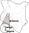
Parks & reserves: Lake Baringo
Access
The road upgrades in Kenya are making it possible to cover greater distances in a single day trip. The 307 km that separate Baringo from Nairobi used to be a journey that was better to split into two days. Since most safaris include a stop at Lake Nakuru National Park, which is roughly half way between Nairobi and Baringo, this used to be the starting point to reach the northern lake, 125 km away from Nakuru. The road is good tarmac.
Eldoret is only 138 km away from Baringo, but the road is much worse. If you intend to make it from Samburu, bear in mind that the 300 km of rough to terrible roads bind you to a midway overnight stop, for instance at Maralal reserve. Obviously, a comfortable journey is from the nearby Lake Bogoria National Reserve, but the lack of lodge accommodation there makes most safaris to choose right the opposite, making Bogoria as a daytrip from Baringo.
Driving from Nairobi, take the A104 heading for Naivasha, Gilgil and Nakuru. Some 30 km past Nakuru you will turn right to the B4, toward Kampi Ya Moto, Bogoria, Marigat and Kampi Ya Samaki, the latter town being at the lakeshore 2 km away from the main road. The road is tarmac up to the north tip of the lake.
From Eldoret, take the C51 heading northward to Cherangani Hills. 33 km ahead, at the town of Iten, the road turns southeast. From there you will pass the towns of Kamarin, Tambach, Chebloch and Kabarnet to finally reach the junction with the B4 in Marigat, where you will turn left for Kampi Ya Samaki and Lake Baringo.
Finally, from Samburu you will head north along the A2 past Archer's Post. 22 km ahead you will turn left to the C78 leading to Wamba, Kisima and Maralal. This route will shatter your wheels and you will rather stay overnight at Maralal. The next day, take the same track you used to access the reserve and head on to Kisima, where you will turn right to the C77 heading southward for Rumuruti. After 33 exhausting kilometers, you will turn right to the C77D. This road traverses Lerogi Plateau and borders Laikipia Plains, rewarding you with an interesting journey through the Tugen and Pokot lands and splendid vistas of Lake Baringo. The road passes Tangulbei and leads to Loruk, at the north end of the lake. Beware, along this whole journey there is petrol available only at Archer's Post, Maralal and Lake Baringo Club. In addition, after the rains you will find plenty of mud along the roads.
From Nairobi and Eldoret there are several buses and matatus to Nakuru every day. From here, there are two daily buses to Kampi Ya Samaki, but matatus only reach Marigat.
The boats for Ol Kokwe island, where Island Camp is located, may be hired at the jetty north of Kampi Ya Samaki.
|